


At last count, Australia had a staggering 8,222 islands.
They range from those just outside the mainland to those in the Pacific, Indian, and Southern Oceans.
But how did all these islands come to be?
Maria Seaton, a marine geoscientist and plate tectonics expert at the University of Sydney, says most of the world’s islands are created by underwater volcanoes.
When ejected lava accumulates, it forms a seamount, which eventually grows to the point where it appears above the waves, giving rise to an island.
This process can take tens of millions of years, after which the island slowly sinks into the ocean under the weight of the volcanic rock.
But what causes these volcanoes in the first place? What about islands that were not created by volcanoes?
From hotspots and continental collisions to shifting sands and changing sea levels, take a tour of eight incredible islands and discover how they came to be.
Lord Howe Island and the Norfolk Islands
About 600 kilometers off the coast of New South Wales lies a popular island formed from a volcano. The last eruption was 7 million years ago.
Lord Howe Island is actually part of a series of volcanoes, with the remaining volcanoes all completely submerged.
Dr Seaton said the island formed as the Australian continent moved over a “hotspot” – a plume of super-hot molten material beneath the Earth’s crust.

These are the same processes that formed Hawaii, where volcanoes are still active today.
Further east, Norfolk Island has stately pine trees and an interesting Polynesian and European history, home to convicts and rebels.
Now the product of an extinct volcano and long thought to be the result of a hotspot, Norfolk Island is a little different.
Collision of tectonic plates can cause cracks in the Earth’s crust that lead to volcanoes, but this occurs in areas relatively close to “subduction” zones (where one tectonic plate slides beneath another) There is a tendency.
It is therefore thought that ‘intraplate’ volcanoes such as Lord Howe Island and Norfolk Island, both thousands of kilometers from the Australian plate boundary, must have formed from hotspots.
But Dr Seaton says Norfolk Island was formed differently than Lord Howe.
When the Pacific plate slides beneath the Australian plate, cold water and rocks plunge into steaming hot magma.
For many years, this has prevented the circulation of magma over long distances. Affects areas far from subduction zones.
And it triggered volcanoes in places like Norfolk Island, probably areas where the Earth’s crust is inherently weak.
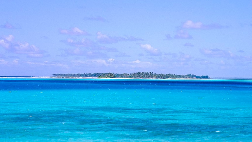
Christmas and the Cocos (Keeling) Islands
On the other side of the country, between Western Australia and Sri Lanka, are Christmas Island and the Cocos (Keeling) Islands.
A rich blend of cultures, they also have an interesting history, including feuds between settlers and harems.
But unlike Norfolk Island and Lord Howe Island, these islands are relatively close to plate boundaries, giving rise to extensive seamount “provinces” over tens of millions of years.
“That’s more than the area of New South Wales,” says Tim O’Hara of Museums Victoria, who was lead scientist on a research trip to the region in 2021.
“There must have been more islands, but they sank a long time ago,” Dr O’Hara says.
Christmas Island is located just a few hundred kilometers from Indonesia and is known for its immigration detention center and incredible schools of red crabs.
Experts say the island was actually born twice.
The first time, Dr. O’Hara said, was when a giant ancient volcano erupted and then sank into the ocean.
Then, millions of years ago, the island was lifted high above the water.
“Australia is being pushed beneath Eurasia and is buckling as it descends,” Dr O’Hara said.
“Christmas Island is sitting on a buckle, which means it’s actually being pushed up into the air as it descends.”
Christmas Island is over 350 meters above sea level, while the Cocos (Keeling) Islands to the east are pancake-flat and covered in coral and coconut palms.
These islands form a classic circular coral atoll, where former volcanic islands sank beneath the waves, leaving behind coral reefs.
Heard Island and Macquarie Islands
The next volcanic island on your whistle-stop tour is a remote, pristine land of fire and ice known as Heard Island.
This ruggedly beautiful sub-Antarctic island, located 4,000 km southwest of mainland Australia, is another volcanic hotspot.
But unlike Lord Howe, the island continues to be formed by an active 2,745 meter tall volcano called Big Ben.
“Big Ben continues to erupt and build islands to this day,” said Macquarie University geologist Nathan Datsko.
Also in the Southern Ocean is Macquarie Island, 1,500 kilometers southeast of Tasmania.
It was considered a possible penal colony in England, but was ruled out because it was too remote and stormy.
Like Heard Island, seals and penguins were once hunted but are now protected.
However, this is the first island on our tour that was not created by a volcano.
Instead, it was formed when the Australian and Pacific tectonic plates gently collided, bending the ocean floor and pushing it 3 to 4 kilometers upwards.
“This is the only place in the world where people can go and see above sea level a part of the ocean floor that has not been deformed or destroyed by the uplift process,” Professor Datsko says.
This island is very young, having only emerged from the sea about 600,000 years ago.
And as soon as the plates stopped pushing against each other, Professor Datsko added, Macquarie Island would sink into the ocean.
kangaroo island
Head back north and you’ll find Kangaroo Island, located at the tip of South Australia’s Fleurieu Peninsula.
At approximately 4,500 square kilometers, it is one of Australia’s largest islands and is actually part of the continent. As sea levels have risen and fallen over the past million years, the island has repeatedly separated and reconnected with the mainland.
During the period of isolation, rare animals evolved, like the small emu, which went extinct in the 1800s.
“It was a dwarf version of the mainland species,” says University of Adelaide palaeontologist Diego Garcia-Bellido.
“They were so docile that they were wiped out by the first sealers and whalers.”

Going back even further, 500 million years ago, when Kangaroo Island was part of a huge underwater basin in the Flinders Ranges, it was home to some super weird creatures.
As discovered by Professor García Berrido, these Cambrian seas were home to giant shrimp-like creatures called lobsters. Anomalocaris daleyae It had large eyes and terrifying appendages for stuffing prey into its mouth.
And amazingly, these soft tissues have been preserved for millions of years in the rock of the island called the Emu Bay Shale.
“This is a very special type of fossil site, the only one of its kind in the entire southern hemisphere,” says Professor García-Bellido.
Kangaroo Island and its amazing fossils were not only exposed by lower sea levels, but the entire area was exposed by uplift in recent geological times.
Kugali (Fraser Island)
Finally, return to the east coast where your tour began and discover Kgari (Fraser Island), the world’s largest sand island.
More than 123 km long and 25 km wide, the island did not involve volcanic or continental uplift, but is made entirely of drifting sand.
Wind and waves carried sand up the coast of southeastern Australia for hundreds and thousands of years, but when it reached Kugali, the conveyor belt stopped and the sand was deposited.
This is partly due to the shape of the Australian coastline in this location curving fairly sharply to the northwest, making it difficult for sand to continue progressing north.
Jamie Schulmeister of the University of Canterbury, who has studied the island in detail, said that analysis of Kgari’s sand has shown that the island is about 900,000 years old.
Schulmeister and his colleagues argue that Kugali was built in “pulses” over hundreds of thousands of years, as changing patterns of sea level brought sand that had been pushed offshore back to the island.
Kugali may also have played an important role in the formation of the Great Barrier Reef, Professor Schulmeister added, adding that it acted as a “seawall” to prevent sand from suffocating corals to the north. .
“If we take Kigali away, the sand that has come up the eastern side of Australia will continue all the way to the southern Great Barrier Reef.”
Well, our island trip has come to an end. You might want to learn more about the forces shaping Australia.
First of all, why not feature the history of Uluru’s formation?
Get all the latest science articles from ABC.


